Meeting Monday, Jan. 18, the Cottage Grove Plan Commission held four public hearings, with the meeting lasting over almost four hours. Three public hearings were all but routine, and will head to …
This item is available in full to subscribers.
To continue reading, you will need to either log in, using the login form, below, or purchase a new subscription.
If you are a current print subscriber, you can set up a free website account and connect your subscription to it by clicking here.
Otherwise, click here to view your options for subscribing.
Please log in to continue |


Meeting Monday, Jan. 22, the Cottage Grove Plan Commission held four public hearings, with the meeting lasting over almost four hours. Three public hearings were all but routine, and will head to council shortly.
The fourth public hearing, a proposed housing development to be known Mississippi Landing II, is also headed to council, while seeing a good deal more involvement from the public along its way.
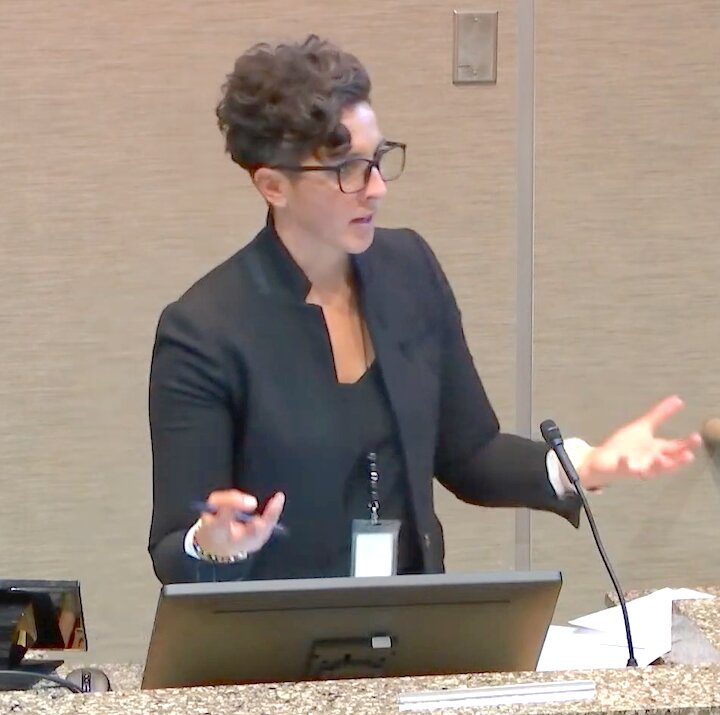
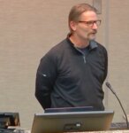
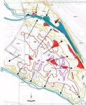
Prior to the public comment opportunity on Mississippi Landing II, were presentations from the city and developer of the proposed housing site at the old Mississippi Dunes Golf Course. Community Development Director and city planner Emily Schmitz led out the night’s presentations by acknowledging the past.
“Good evening chair, members of the commission. I know some of you probably opened your packet over the weekend and said ‘my goodness, I’ve seen this before,” she said as she opened a brief history on the Dunes development. “This is a very similar proposal to what what brought two years ago, Pulte was in front of you.” Showing historical photos from the air on how the site had changed, Schmitz then went over a brief site history, ending with the present golf course.
“As you can see that mass site grading touched every area of the site,” Schmitz said of transition to golf course in the 1990s. Later closed as a golf course in 2017, the property was purchased by the current property owner in 2019. Prior to the golf course closing, the city had used special planning tools to designate it as a transitional area, giving the city more say in what might happen.
“This was under the thought process that a golf course could redevelop and we wanted to differentiate it from the park that was adjacent,” Schmitz said of the logic behind the city’s move.
Initially zoned as R1 rural residential (which designation is used for rural lands and parks alike), the change in ownership and subsequent events had brought a development proposal.
Seeing but not liking it, the council had the plan calling for medium and high density at the site back to the drawing board for single family homes as more in line with the neighborhood, later using a 2022 land use amendment to align the proposed housing site with the city’s master plan. Among the historical details touched on by Schmitz were the following:
• Negative declaration for Environmental Impact Statement (EIS) following the Environmental Assessment Worksheet
• Rusty Patch Bumble Bee Habitat Assessment
• A 58 page Phase I Archeological Survey by Westwood
• Rare Plant Survey, and
• NHIS Letter dated Jan. 16, 2024
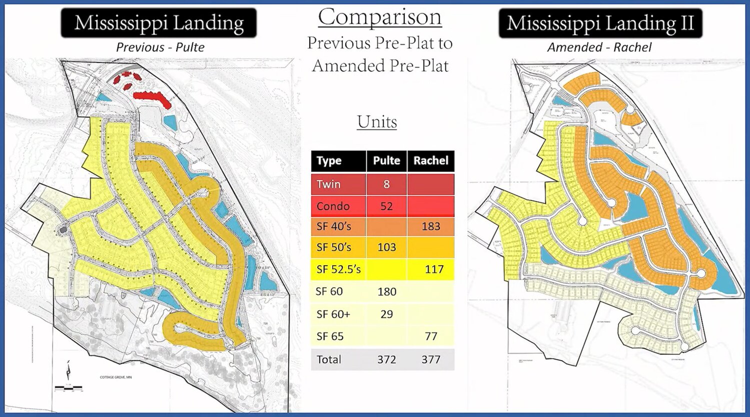
As part of the process, Pulte had drawn up a single family home plan as directed, later pulling out of the proposal. The site then came under Rachel Development for the current plan, known as Mississippi Landing II.
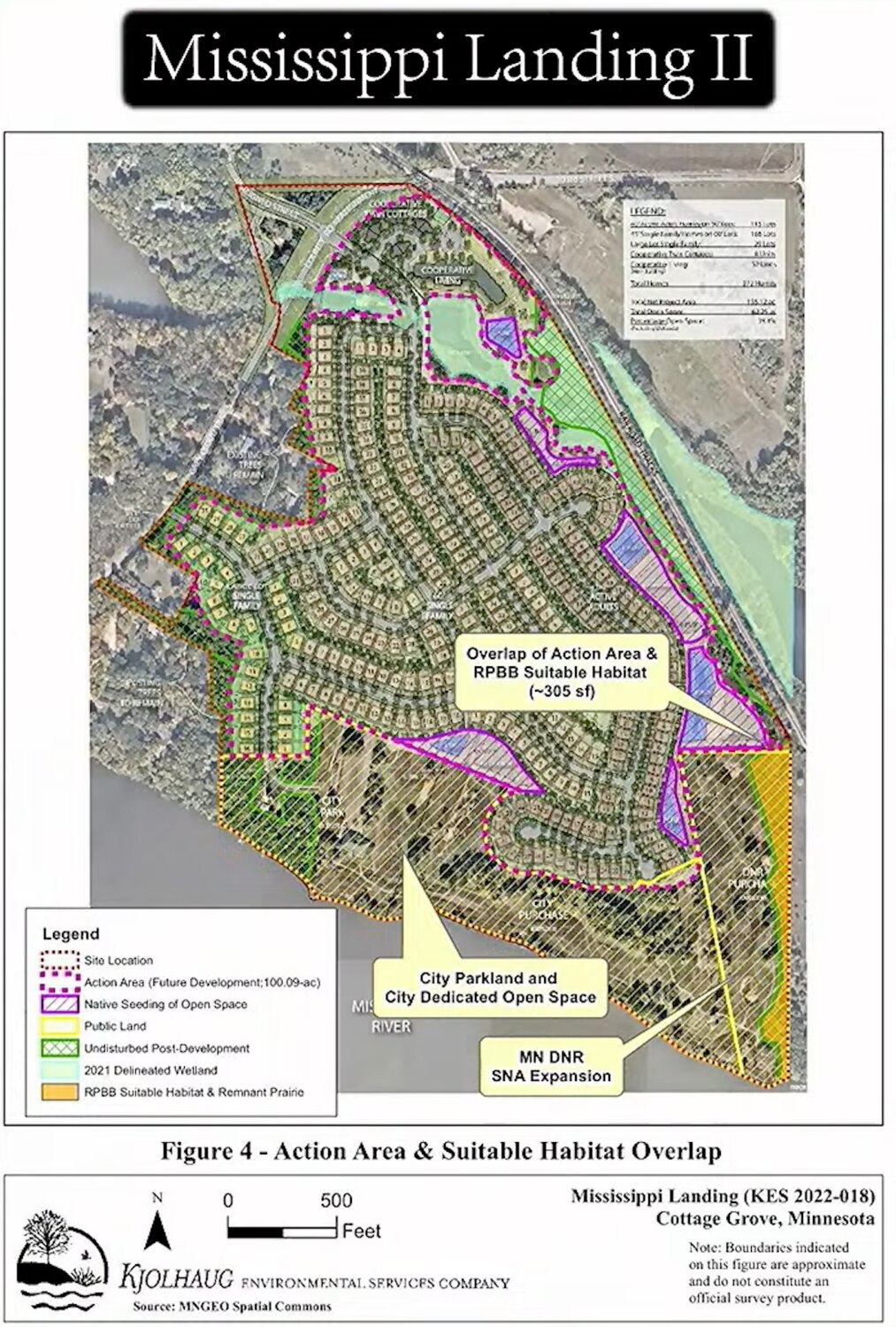
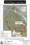
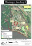
Additionally, while both the prior plat by Pulte and current plat by Rachel Development call for around 40 acres of park and open space near the river, the current plan also calls for the old driving range to be conserved.
“It’s important to note that the triangle as we affectionately call it internally, which is the old driving range, was and continued to be guided as medium density,” Schmitz said of the 2022 land use amendment before showing this would be instead preserved under the current proposal.
Moving from the background to the present thinking, Schmitz said the preliminary plat by Rachel Development proposed 377 single family lots with a net density of 2.47 units per acre. The lots as proposed by Rachel Development will be zoned R3 to R5 under city code and are split between 40 foot wide lots similar to Settlers Bluff, as well as 52 foot wide lots like those of Hinton Woods, and 65 foot wide lots close to the river, similar to Park Pointe neighborhood.
“Just to give your a reference,” Schmitz told the Plan Commission.
Additionally, homes on the proposed riverfront development would be built by Capstone, M/I, and an undisclosed custom home builder.
“We’ve asked several times but he won’t disclose,” she said of the developer and who the custom home provider would be.
Also shared by Schmitz was that access to the proposed development known as Mississippi Landing II would be through two outlets, one near 103rd Street and another on Grey Cloud Trail. The proposed development would also require a permanent lift station to move waste upslope to the sanitary trunk, while storm water would be gathered in pools onsite and filtered before moving to wetlands and being discharged to the Mississippi River.
But while the earlier Pulte proposal called for a higher density senior living unit in the north, Schmitz said of the Rachel preliminary plat that, “in this particular case it is all proposed as single family so we averaged the density across the site.”
With lots zoned from R3 to R5, the site will also have a Planned Use Development (PUD) overlay, providing extra flexibility to preserve things it couldn’t if the codes were followed more strictly.
Also covered by Schmitz, the site is located in the Mississippi River Corridor Critical Area (MRCCA), while overlays the site.
“These are also standards developed by the DNR but the city does enforce those,” Schmitz said of zoning and the MRCCA. “So it is an overlay district within our zoning code.”
Divided into two parts, the site involves 20 percent or a proposed 46 acres preserved within the RN district of MRCCA, as well as an additional 64 preserved acres or 10 percent of the Separate from River (SR) the SR district of MRCCA. Put together the two areas totaling 110 acres comprise 87.67 additional acres over that required for preservation, and includes an option of turning the old driving range from medium density into conservation area with the DNR.
“So in summary this proposal is preserving 110 acres as park, open space, ponding and wetlands,” Schmitz said. Included in this were 9.6 acres of donated land known as outlet C, positioned on the river in the area of the old clubhouse, giving access to the 19.91 riverfront acres purchased by the city along with county partnership.
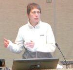
Following Schmitz’s presentation on the basic site and proposal details came one from Rachel Development, in the person of Paul Robinson.
“Good evening Chairman, Commissioners. Paul Robinson, development director for Rachel Development. Some may know us from across town, we do development all throughout the Twin Cities.”
Around for 10 years with around 95 projects totaling approximately 5,800 units, examples of projects by Rachel Development include:
• Highlands on Dunkirk at Plymouth
• Norbella/Assisted Memory Care at Prior Lake, and
• Novo Apartments at Richfield
Robinson additionally shared that in a prior role with Bancorp Group he had helped develop Eastbrooke in Cottage Grove, a development that had received the 2019 Bennie Award. Giving an overview of what would be covered, Robinson then dove into his presentation.
“Acreage is based on the Washington County GIS,” he said, embracing 200.5 acres in all. With four acres to be dedicated along the riverfront in addition to what was previously dedicated, “40 percent of this total site is going into the public domain,” Robinson said.
Sharing that he had done more work on Mississippi Landings II than other sites, Robinson said that Braun Intertec served as the company for test pits and soil borings at the site.
“The vast majority of the site is SB or SBM sand, and is quite suitable for housing,” he said, with some shallow bedrock that will need to be worked through and soil scientists on site during construction to ensure 98 percent compaction, “and all the things you would need to support a home,” he said.
Robinson shared that the company objectives when looking at design included developing a high quality neighborhood connected to the river and open spaces, with a variety of homes at a variety of price points, keeping trail connections along with open space and wetlands, and also financially viable.
“The buildable area—the amount of area that’s being disturbed—is the same,” Robinson said of the Rachel preliminary plat versus the earlier Pulte one. “So we’ve made some changes and we think we’ve made it better but we’ve really stayed within the footprint of the original plan,” he said.
One of the biggest plan changes from Pulte that shared by Robinson was with stormwater ponds at the site.
“One of the biggest changes that we made was moving the ponding from the outside perimeter to inside the site, to create a little more open space and amenity,” he said. These areas would catch and filter stormwater before discharge, with plans to seed native grasses in the stormwater area. The amended plat also removes twin homes and condos from the upper portion of the site and replaces these with single family homes, while adding the larger 65 foot lots near the river to increase value.
Robinson shared that there would be three neighborhoods. The first proposed neighborhood on the east side of the plat would have Capstone Homes on 40 foot wide lots, being priced in the 400s with sizes ranging form 1,700 to 2,800 square feet.
The second proposed neighborhood would have M/I Homes on 52 1/2 foot lots and be divided into two types: two story smart series homes on the north central portion, these priced in the mid 400s to low 500s and sized from 1,300 to 2,600 square feet, along with single family ‘empty nester’ villas priced in the high 400s to low 500s and sized from 1,245 to 2,600 square feet.
The 65 foot lots on the river would be similar to the Eastbrooke neighborhood and start in the mid to high 700s, he said.
“But we’ve had more interest than we can take builders, so we’re in a position of trying to pick the best people who can play in a sandbox together in that area,” Robinson said of the custom homes builder.
With three signs to be made of limestone and placed at both entrances as well as near the old clubhouse parking lot, Robinson said that, “we’re trying to base it more like a national park, the river national park.”
Touching briefly on what happens if archaeological resources are found—“construction stops” and evaluation starts—Robinson said there would be 3.37 miles of trails and sidewalks to connect the neighborhood, along with park trails.
Archaeological resources have previously been identified across the water from Mississippi Dunes and in the River Hills neighborhood to the east, as denoted in the Southwest Arterial Study. The resources located across the water on Lower Grey Cloud Island caused rejection of an arterial corridor across the former golf course, due to the opposite shore containing such resources. The shore immediately opposite the Dunes is also owned by Washington County as part of a proposed regional park.
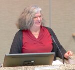
Following the presentations by Schmitz and Robinson, Melissa Barrett of Kjolhaug Engineering presented on environmental aspect, including species present or to be affected.
“My name is Melissa Barrett with Kjolhaug Environmental Services,” she began. “I’ve been an environmental consultant for 20 years with Kjolhaug Environmental.
Among Barrett’s responsibilities at Kjolhaug is helping clients work their way through environmental regulations when planning a project.
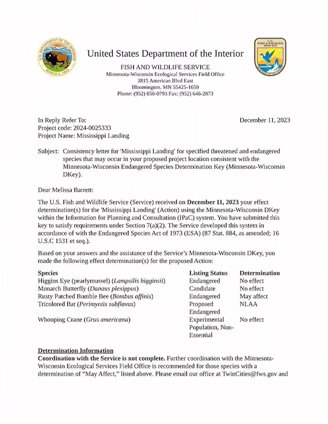
First addressing a National Heritage Information System (NHIS) letter from the DNR dated November 2021, Barrett listed the species within a one mile radius of the project area, including:
• Rusty Patch Bumblebee (federally endangered)
• Henslow’s Sparrow and Loggerhead Shrike (state endangered), and
• Sea Side Three Awn along with Louisiana Broomtrape (threatened).
Other animal and plant species listed include the Bell’s Vireo, Leonard’s Skipper, North American Racer Snake, Lark Sparrow, various mussels and fish, Purple Sandgrass, and Hills’ Thistle.
As for the federal or state endangered species, suitable habitat for the Rusty Patch Bumblebee includes grasslands and tall grass prairies with pollen from flowers and underground nesting sites in abandoned rodent cavities. Habitat for the Henslow’s Sparrow includes uncultivated grasslands and old fields with stalks and a substantial litter layer, with grass too short or manicured a species turnoff. The Loggerhead Shrike inhabits grassy open area with scattered trees and shrubs, including pastures, prairie patches and grassy roadsides.
Other animal species listed in the NHIS letter from 2021 include the Bell’s Vireo, Leonard’s Skipper, North American Racer Snake, Lark Sparrow, various mussels and fish, Purple Sandgrass, and Hills’ Thistle.
“The letter stated that if the project were to affect the water quality then a mussel survey would be needed,” Barrett said. “We evaluated this and we are not doing that survey, it doesn’t need to be done.” The plan to address this in turn was to follow erosion control plans along with Storm Pollution Prevention Program (SWPPP) plans, she said.
Regarding the four listed state bird species, “no bird surveys have been done, they are not going to be done.” So long as the developer made sure to avoid tree and shrub clearing from April 1 to August 15, these were “not needed,” Barrett said.
Regarding the North American Racer Snake and Leonard’s Skipper (a type of butterfly), Barrett said that there was a DNR recommendation to add a biodegradable erosion control blanket, which had been added to the plans by Rachel Development.
“The developer has added that to the plans.” Additionally, verification had been sought and received that surveys would not be needed for the two species listed, Barrett said.
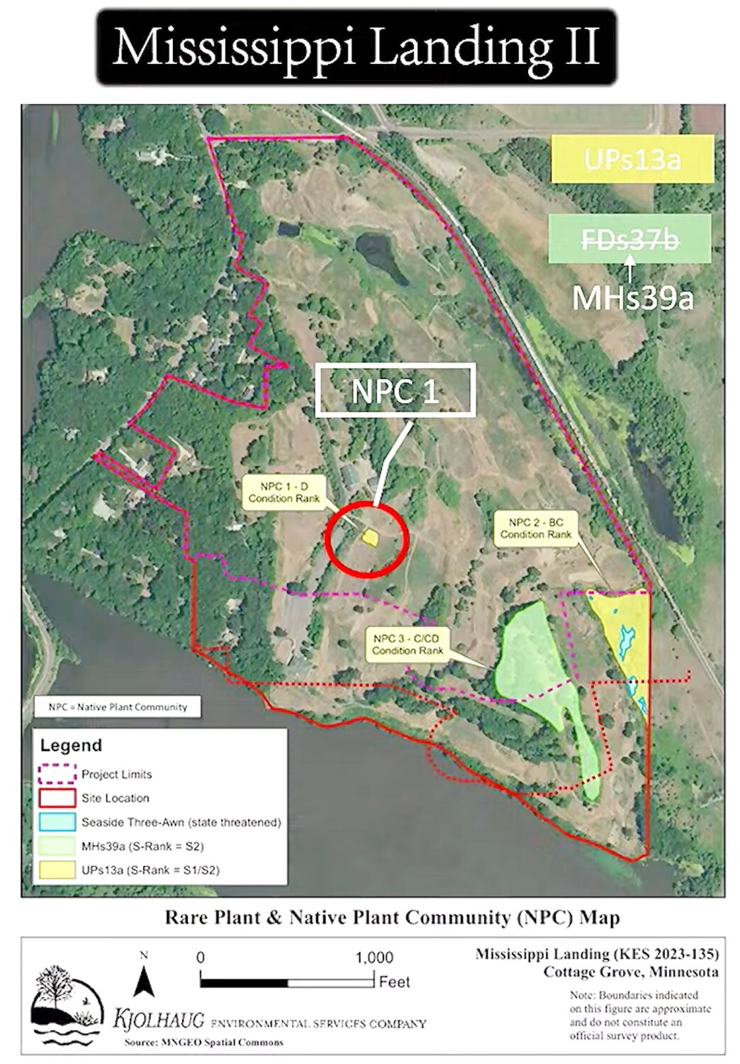
With regard to threatened plants, the Seaside Three-awn and Louisiana Broomrape were listed, while species of special concern in the state are the Hill’s Thistle and Purple Sandgrass.
“The DNR letter specifically said that ‘a qualified surveyor would need to conduct a habitat assessment in any undisturbed area s impacted by the proposed project. If potential habitat for this species is documented and those areas cannot be avoided, a botanical survey will be needed.”
Barrett said that in response Midwest Natural Resources (MNR) had been contacted and that, “we asked them to survey the whole site,” rather than just parts of it. MNR is on the list of qualified DNR surveyors.
“There job was to go out and see what they could find on the golf course,” Barrett said. “We didn’t have them survey anything on the east side of the railroad tracks. We knew that was off limits for the project. But everything to the west of the railroad tracks within the project area, we said go see what you can find anywhere.”
Sea side Three-Awn was found in the area to be part of an SNA extension.
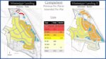
None of the other listed plants were found during the survey, with updated maps showing altered landscape from the 1987 Biological Survey that showed a dry barrens prairie with “high” biodiversity, prior to the golf course. A sugar maple basswood forest with condition rank of C/CD was found on the southeast portion of the golf course, partly witting the plat area for 65-foot lot homes. The same area had been surveyed as a Pin Oak-Burr Oak Woodland in 1987.
Given these results as submitted earlier by Pulte Group, Barrett said a DNR review had determined that a “take” permit was not needed for the site.
“They acknowledged that those rare species are out there, but that the project is not expected to impact those rare species and that a take permit was not needed,” she said, adding, “That’s kind of how that works.”
But there was still the Rusty Patch Bumblebee to cover.
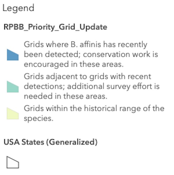
“Because that’s the real question,” Barrett said of conservation and species in the area. Listed as federally endangered in 2017 after losing 87 percent of its habitat as needed for survival, the Rusty Patch Bumblebee (Bombus affinis) nests underground in overwintering sites, with the destruction of queens leading to destruction of colonies.
Remaining populations of the bumblebee are subject to multiple factors that induce species stress including, “pathogens, pesticides, habitat loss and degradation, non-native and managed bees, the effects of climate change and small population biology,” per the U.S. Fish and Wildlife Service website. Insufficient diet from loss of floral species is also thought to play a role in the bee species decline.
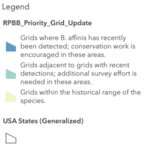
As to conservation, Barrett said the official determination on the site was that it would not affect the Rusty-Patch Bumblebee, with suitable area in the resurvey of Mississippi Dunes since 1987 amounting to just 305 square feet of overlap with the preliminary plat, adjacent to an SNA expansion.
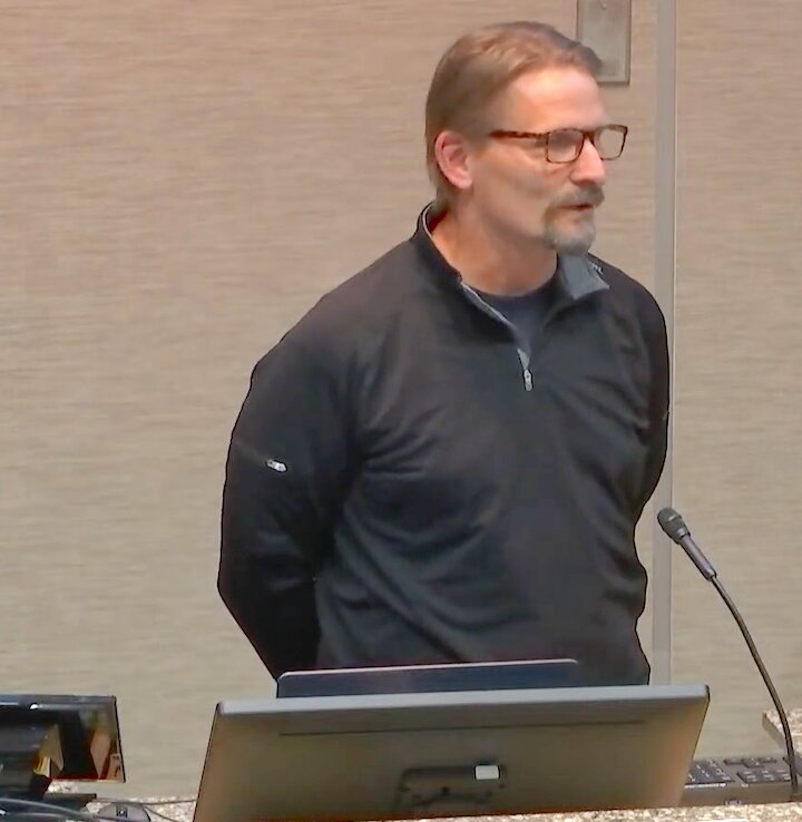
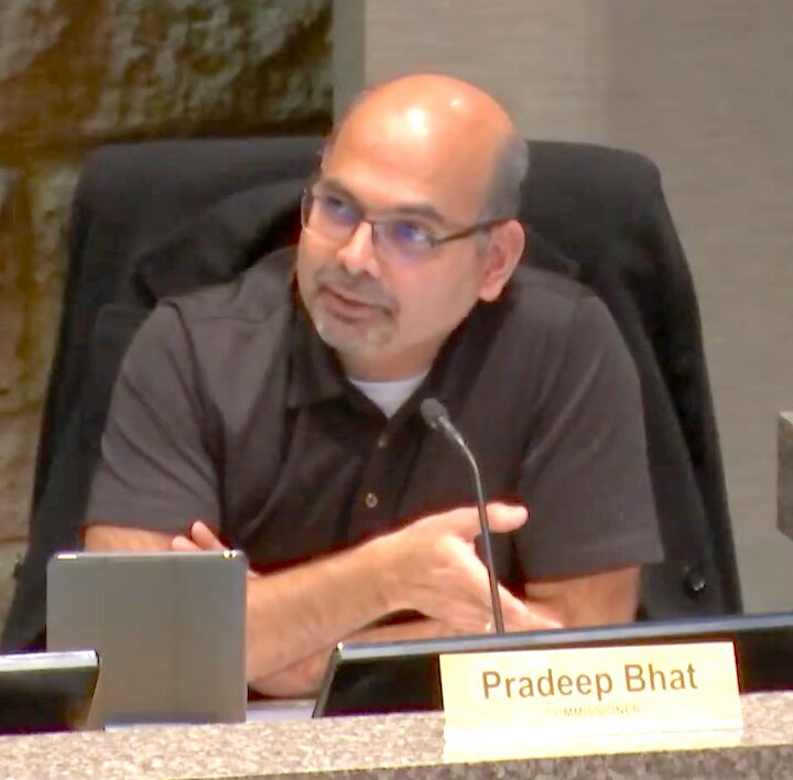
Plan Commissioner Prandeep Bhat then brought up an email received from an employee of the U.S. Fish and Wildlife Service to the Plan Commissioners that Bhat said seemed to contradict what was being said by Barrett.
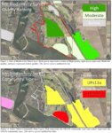
“So I was wondering, why is there a contradiction there?” He said of the email that Commissioners had received. The area for Mississippi Landings II is in a high potential area for the Rusty Patch Bumble Bee, where presence should be presumed for Section 7 purposes under the ESA.
“Is yours dated January 20, 2024?” Barrett asked of Commissioner Bhat’s email letter, receiving an affirmative response.
“If you look at the comment or determination, it’s contradicting,” he said.
“And I would say the reason it’s contradictory, and I thank the person for highlighting that. Number 10 of my form and number 10 of their form would be different.” Barrett then read from the form.
“It says, ‘does your project have the potential to impact a riparian zone or indirectly impact a stream or river? Through cut and fill, horizontal directional drilling, construction, vegetation removal, pesticide or fertilizer application, discharge, runoff of sediment or pollutants increase in erosion.” Barrett then explained the divergence.
“And if the stormwater plan is followed, if the erosion control plan is followed, those things will not occur,” she told Bhat. “The applicant would not be given a permit for his project from the city or the watershed district if they felt those things would occur.”
Barrett said she didn’t think it would cause sedimentation because she knew that a stormwater plan was in place, then clarified with chair Evan Frazier that anyone could go online to the Department of the Interior and fill in the coordinates for the worksheet, filling in their own answers.
Following the presentation by Barrett, it was question time from the Plan Commission, with Chair Evan Frazier asked Schmitz the particulars of mass-site grading as covered earlier.
“My engineer friends are giving me the eye because I’m going to give the planner version, but basically every inch of the site was graded,” Schmitz replied of the golf course age. Jessica Fisher then asked if the earlier environmental work had been done after the golf course came, receiving a negative answer.
From commissioner questions it was into public comment, of which there was plenty, being capped at three minutes a person.
Below are some of the many comments made.
Eric Dammer of Cottage Grove:
“I rise in opposition to the proposed development. I believe in preserving that which is best in a community, preserving it for those who come after us. Now the arguments that are going to develop here are not new arguments that haven’t been done before for generations, right? 100 years ago there was a battle in Minnesota. On one side there was powerful industrial interests led by a gentleman named Edward Backus and their plan was to construct a series of dams on the Rainy River watershed. And they were going to control the water flow through Backus’ hydroelectric dam in International Falls. Now he promised great things: there would be great benefits to the community, there was going to be improvements to the natural environment by these huge impoundment lakes and stuff like that. And their side had money and political influence on their side.
On the other side was an ad hoc group led by an Ivy League educated self taught naturalist named Ernest Oberhauser. And what they had was a powerful vision. And that vision was that you preserve places in a state of nature so people in that generation and future generations can connect with the land and rejuvenate and renew their souls and their spirits. Now we know that Oberhauser’s side won that battle right? But what if it had been a little different and the other side had won? Today we’d be questioning the judgement of the leadership of that era, as we’d be facing the huge task of tearing down those dams and rehabilitating those lost waterfalls and river rapids and thousands of islands drowned under those lakes. That land was the land that became the BWCA, that jewel of northern Minnesota. That land was land that Backus claimed was of no particular value to even be considered.
Now what are people going to think of this little argument going on here 100 years from now? Are they going to thank us for another nondescript housing development lost in a sea of nondescript housing developments? Or instead will they appreciate us for having the vision to preserve what was best in our community, and leave them open and accessible places to easily experience the waters of the Mississippi River, to be in nature and renew their spirit? We ask that you have the vision to create a work as worthy of the canvas you’ve been provided with.”
Dave Olson of Cottage Grove:
“Chair and Commission members, thank you for allowing me to share my perspective on this application before you tonight. I understand that your job is to make sure it complies with all of the codes and ordinances in our city. And I’m pretty confident that our city staff wouldn’t have it in front of you today if it didn’t. So I’m pretty sure I know how this vote’s going to go and I understand why it needs to go that way. I also want to thank each and every one of you for doing this hard, hard work on behalf of the rest of us who live in Cottage Grove, so thank you very much.
Council member Khambata, you can see and I think you’re going to hear that there’s a whole lot of dedicated citizens that are concerned and motivated to try to prevent this project from happening. And I would only ask that you share that with your fellow council members and the mayor when it comes time for this to go through on the consent agenda.
Landowner, I hear rumor that you really don’t want houses here, so slow down. I think there might be another way. There’s a lot of people trying to find another way. And Rachel I listened to you all, so I have to change what I was going to say, because I’m very, very impressed with your due diligence, very impressed. Thank you for doing that. The thing is, we just don’t want you to ruin this land with houses, and we think that’s what it will be is ruined. And you actually hold the cards right now, so please, just stop. Let’s not do this. If the volunteers can generate enough money to satisfy the landowner’s need for compensation on their investment. Thank you.”
Andrew Marotz of Minneapolis:
“Evening Commissioner and my friends. My name is Andrew Marotz. I am your neighbor up the river in Minneapolis….I’m a habitat restoration ecologist, a wildlife biologist, and a community partnership specialist in natural resources. I would echo the things that most of our friends have said already tonight, and I’ll offer my own perspective on something outside of that.
My history with the site, I’ve hosted hundreds of volunteers on Grey Cloud Dunes SNA over the years doing seed collection and invasive species management onsite. I’m also an interpreter and I’ve shared the story of the connection of the Dunes and Mississippi River. One thing I’d like to share is you’re very fortunate on this site. If you do choose to go the path of something other than development and restore the habitat, you’re in very good luck. The site is in pretty remarkable condition considering what’s happened to it over the years. There’s a lot of things left intact that could be quite easily restored. On top of this you have a pretty incredible coalition of natural resource management organizations that would be jumping at the bit to manage this site with you and restore it to its former habitat.
Who knew there was a national park in the Twin Cities? The Mississippi National River and Recreation Area—this falls within that site—the National Park Service and their partner the Mississippi Park Connection would have volunteer resources, monetary and grant funding opportunities to restore the site. The Friends of the Mississippi River already involved with the park planning on site as well. You have some incredible site stewards through the SNA program and the ability to engage countless community members through this process as well.
I commend the developers for setting aside so much land—40 acres is pretty incredible and will create an awesome river park with amazing access to the water, but it will be nowhere near the ecological functionality that could be gained by restoring the entirety of the site, particularly the dry prairie site.
Again, I commend you all for meeting your legal needs and going above and beyond as the plant survey isn’t called for, but I would recommend mussel surveys, bird surveys, snakes and butterflies in an official capacity as well. Thank you.”
Kendra Sommerfeld of South St. Paul:
“My name is Kendra Sommerfeld, I live across the river as well…It’s kind of nice that I am following a fellow professional here because as a water resource professional and also a restoration professional that works in protecting and improving our water resources like the Mississippi River I second many of the statements made by everyone here and I have just a few additional comments.
I want to touch on the plant and animal assessments that were completed. They’re a little skewed or flawed in my opinion because the site is already disturbed. It’s already, you know, it’s not a habitat, it’s not what it should be. So there’s not going to be endangered species on there, there’s not going to be native plants on there.
So to say that this project doesn’t have impacts is ‘correct’ in a sense, but instead if you know we were to restore this area to what it was and what it could be, then you would have those very valuable ecological functions and services for everyone, including downstream and upstream and the surrounding areas.
So we have the perfect opportunity to correct those first wrongs, the ag and the golf course disturbances. But instead of correcting not a simple disturbance, but instead of correcting that, which we can, you’re planning on completely destroying the area, putting in houses, and sewers, and septic systems—that is very hard to come back from.
And then I also want you to consider the broader issue of urban development. Look at all of your surrounding cities which are drowning in water quality issues, groundwater contamination, air pollution, flooding issues, because they are fully developed—they have no natural land. So we really have a great opportunity for Cottage Grove to be leaders in protecting this land and keeping those ecological services such as flood control and better air quality and natural spaces for everyone.
So I ask you all to be an example for the entire state and protect this area, do not destroy it. And be a leader in taking care of the environment as well as your community. And just another note is if we continue to develop like this we will have nothing left. Many cities have nothing left besides their small parks.
So you have an incredible opportunity here. Don’t miss out on it. Be a leader and be an example for everyone.”
Following public comment, chair Evan Frazier made clear the matter at hand.
“We as the government cannot tell you what to do with your property,” he told those present, with the ultimate question of what the site now becomes in the hands of landowner David Gustafson and Rachel Development.
Having passed the city plan commission, the preliminary plat for Mississippi Landings II now heads to city council.