To continue reading, you will need to either log in, using the login form, below, or purchase a new subscription.
If you are a current print subscriber, you can set up a free website account and connect your subscription to it by clicking here.
Otherwise, click here to view your options for subscribing.
Please log in to continue
Need an account?
Print subscribers
If you're a print subscriber, but do not yet have an online account, click here to create one.
Online-only subscribers
If you are a digital subscriber with an active, online-only subscription then you already have an account here. Just reset your password if you've not yet logged in to your account on this new site.
Non-subscribers
Click here to see your options for becoming a subscriber.
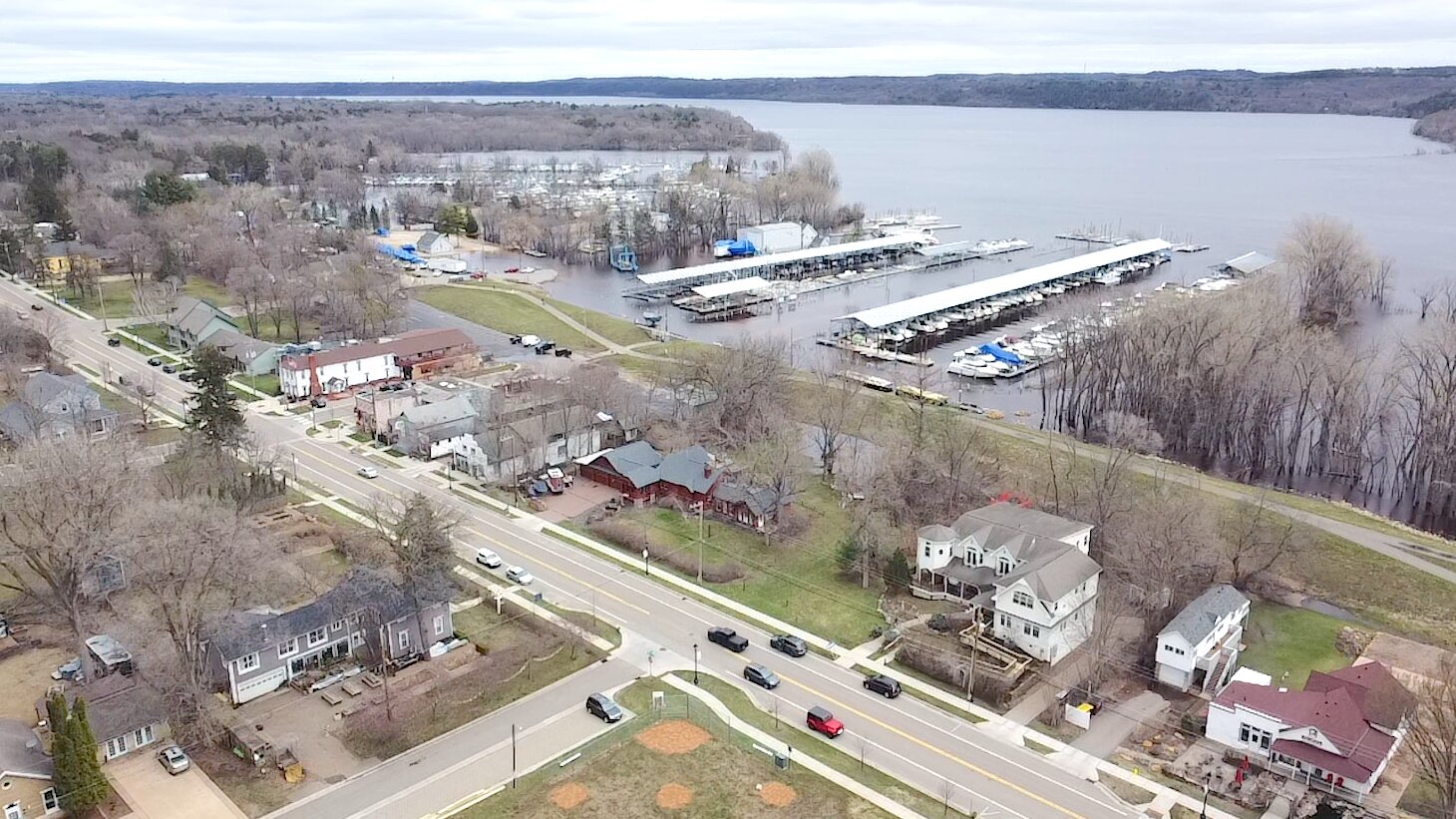
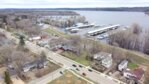
Floodwaters held back
Afton’s levee investment paid off this year, with a line of houses and Main Street staying dry, a recreation trail crowning the levee.
Photo by Joseph Back
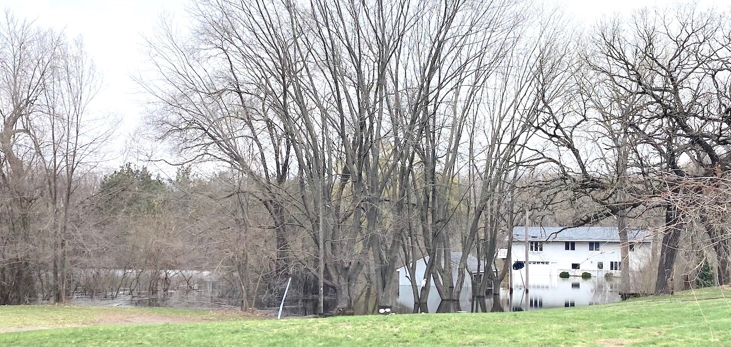
Acquired recently by the City of Newport with FEMA dollars, this house off Cedar Lane showed what can happen when river levels rise above normal, the home due to be torn down.
Photo by Joseph Back
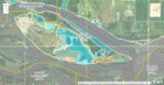
Lower Grey Cloud is linked to the mainland by two bridges, both of which are low set should the water rise high enough.
Flood map image accessed at https://msc.fema.gov.
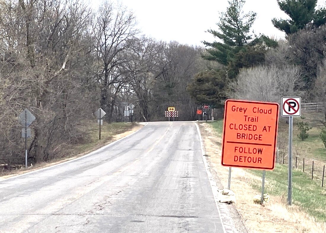
Visitors to Grey Cloud Island were sent on a detour as rising waters led to closed thru traffic on Grey Cloud Island Trail South.
Photo by Joseph Back
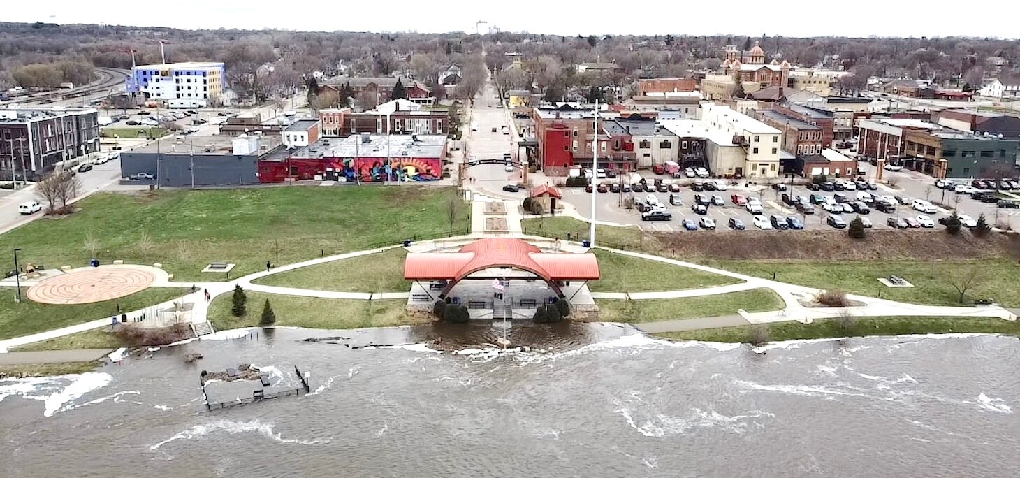
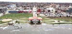
Just across the river at Hastings, the Levee Park flooded, and riverfront trails were closed, but without any private property at risk, the park ready for visitors once floodwaters receded.